 William BensonVIEW PROFILE →
6.7 Magnitude Earthquake Shakes Southern Peru, Felt as Far as the Capital, Lima
Two people were injured and dozens of buildings damaged after the strongest tremor to hit the region in more than two years.
Two people were injured and dozens of buildings damaged after the strongest tremor to hit the region in more than two years.
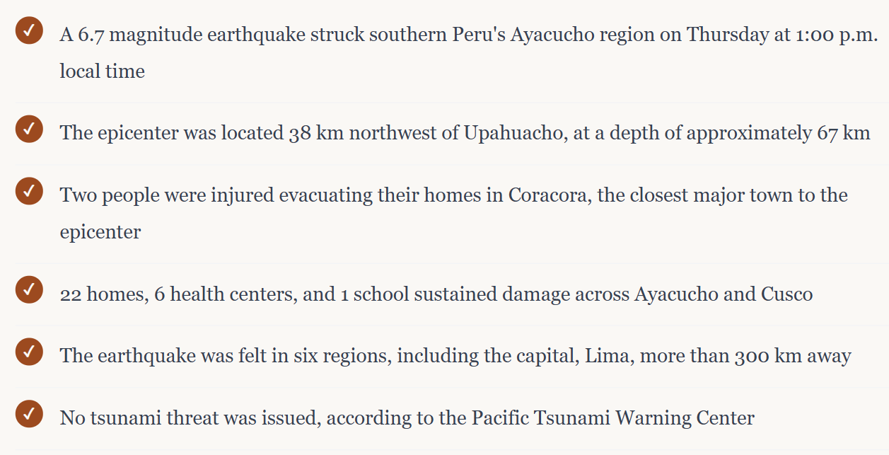
At exactly one in the afternoon on Thursday, life in the small Andean town of Coracora paused mid-motion. Market stalls swayed. Dust began lifting off the dry hillsides in slow, rising columns, visible for kilometers in every direction. By the time the shaking stopped, less than a minute later, a 6.7 magnitude earthquake had rippled outward across six regions of southern Peru, reaching a capital city more than 300 kilometers from where it started. For a country that sits directly on top of one of the most seismically active stretches of the planet, an earthquake of this size isn't exactly rare. But the particular combination of factors here, its depth, its epicenter in a populated highland province, and just how far the shaking traveled, made Thursday's quake one worth understanding in detail, both for what happened and for what it reveals about the region's ongoing exposure to this kind of risk. Where and when it struck According to the U.S. Geological Survey, the earthquake occurred at 1:00 p.m. local time, with its epicenter located roughly 38 kilometers northwest of the small town of Upahuacho, in Parinacochas province, part of the Ayacucho region in Peru's southern highlands. The quake originated at a depth of approximately 67 kilometers, classifying it as an intermediate-depth event rather than the shallower, often more locally destructive quakes that occur closer to the surface. That depth matters more than it might seem. Intermediate-depth earthquakes tend to distribute their energy across a wider area rather than concentrating destructive force directly above the epicenter, which helps explain how a quake centered in a relatively remote highland province ended up being felt so distinctly in a capital city hundreds of kilometers away.A discrepancy in the numbersOne detail that's worth flagging for anyone following the coverage closely: not every seismological agency agrees on exactly how strong this earthquake actually was. The U.S. Geological Survey placed the magnitude at 6.7, the figure that's been most widely reported internationally. Peru's own Geophysical Institute, however, measured the same event at a notably higher 7.2, a gap that reflects real differences in how various national seismic networks calculate magnitude based on their own station placement, instrumentation, and modeling methods, rather than any error on either side.Why magnitude readings can differDifferent seismic agencies often rely on different networks of monitoring stations and slightly different calculation methods, especially in the first hours after an event when full data hasn't yet been processed. It's common, particularly for larger or more geologically complex earthquakes, for initial readings to diverge by several tenths of a magnitude point before later revisions bring the numbers closer together.Whichever figure ultimately proves more precise, both readings place Thursday's earthquake solidly in the "strong" category, capable of causing structural damage to vulnerable buildings and easily felt across a wide radius, which lines up with exactly what was reported on the ground.
How far the shaking reached
Perhaps the most striking detail in the early reporting is just how widely this earthquake was felt. Beyond Ayacucho itself, tremors were reported across Ica, Arequipa, Huancavelica, Apurímac, and Cusco, a spread that touches some of southern Peru's most populous highland and coastal regions. That the shaking reached all the way to Lima, the capital and by far the country's largest urban center, gave millions of residents a direct, if largely uneventful, experience of an earthquake whose epicenter sat far outside the city limits.
For context on scale, seismic monitoring estimates suggested that roughly 35,000 people likely felt strong shaking near the epicenter itself, with progressively larger numbers, moderate shaking felt by close to 200,000 people, and light shaking registered by an estimated two million people further out, a distribution that illustrates just how broadly a single geological event of this size can touch a population.
The human and structural toll
Peru's Civil Defense authorities confirmed that two people were injured while evacuating their homes during the earthquake in Coracora, the capital of Parinacochas province and the community closest to the epicenter. Luis Vásquez, the head of Civil Defense, told reporters that both injuries occurred amid the chaotic, understandably urgent process of getting out of buildings as the shaking began, rather than from structural collapse itself.
Beyond those two injuries, authorities reported damage to 22 homes, six health centers, and one school spread across several districts in the Ayacucho and Cusco regions, including the towns of Puquio, Pullo, Coracora, Upahuacho, San Pedro, and Pichari. Damage assessment teams were still working to determine the full extent of structural impact in the hours following the quake, a process that typically continues for days after an event of this size, particularly in more remote highland communities where access and communication can be limited.
"Two people were injured while evacuating their homes during the earthquake in Coracora."
— Luis Vásquez, head of Civil Defense, Parinacochas province
The dust clouds that made the earthquake visible from a distance
One detail that spread quickly through early reporting and social media was footage of enormous dust clouds rising from the steep, dry slopes surrounding the epicenter. In mountainous, arid terrain like the Ayacucho highlands, strong shaking frequently dislodges loose surface material and triggers small rockslides along exposed hillsides, kicking up dust that can remain visible in the air for several minutes afterward. While dramatic to see, this kind of dust cloud is a fairly common visual signature of moderate-to-strong earthquakes in similar dry mountain environments, rather than an indicator of unusually severe ground rupture on its own.
No tsunami threat, and why that assessment mattered
Given Peru's long Pacific coastline, one of the first questions that follows any earthquake of this size is whether it poses a tsunami risk. The Pacific Tsunami Warning Center assessed the event shortly after it occurred and confirmed that no tsunami threat existed from this earthquake, an evaluation based on the quake's location well inland from the coast, combined with its depth and the type of fault movement involved.
That reassurance carried real weight along Peru's southern coast, where communities remain acutely aware of tsunami risk given the country's seismic history. The absence of a coastal threat in this case meant that emergency response could focus entirely on the inland highland communities actually affected by ground shaking, rather than also managing coastal evacuation procedures.
Damage figures and injury counts reflect information available at the time of writing, based on statements from Peru's Civil Defense authorities. These figures are frequently revised in the days following an earthquake as assessment teams complete their work in more remote areas.
Why Peru sits at the center of so much seismic activity
Thursday's earthquake didn't happen in isolation. Peru sits along the Pacific Ring of Fire, the horseshoe-shaped belt stretching around much of the Pacific Ocean basin where the majority of the world's earthquakes and volcanic eruptions occur. Specifically, Peru's seismic activity stems from the ongoing subduction of the Nazca Plate beneath the South American Plate, a slow, continuous geological collision that has shaped the entire Andean mountain range and continues to generate earthquakes with real regularity across the country.
That geological reality gives useful context for how this week's earthquake fits into Peru's broader seismic history. According to seismic tracking data, this was the strongest earthquake to hit Peru in more than 26 months, a notable stretch given how frequently the country experiences moderate seismic activity, with quakes in the magnitude 4 to 5 range occurring on a near-weekly basis in various parts of the country.
A comparison worth understanding, not repeating
For longtime residents of southern Peru, any significant earthquake inevitably invites comparison to the region's most devastating recent seismic event: the magnitude 7.9 earthquake that struck the Ica region in 2007, which killed close to 600 people and remains one of the deadliest natural disasters in Peru's modern history. Thursday's earthquake, while serious and genuinely disruptive for the communities closest to its epicenter, was a meaningfully smaller event in both magnitude and consequence, a distinction worth making clearly rather than letting the comparison imply an equivalence that the data doesn't support.
What happens in the days ahead
In the immediate aftermath of a moderate-to-strong earthquake like this one, the practical work shifts from the dramatic initial reporting to a slower, more methodical process: structural engineers assessing which of the damaged homes, health centers, and the affected school are safe to reoccupy versus which need repair or rebuilding, aftershock monitoring to track any continued seismic activity in the area, and logistics teams working to get resources into more remote highland communities where road access can complicate response efforts.
Aftershocks are a near-certainty following an earthquake of this magnitude, and seismologists typically expect a series of smaller tremors, most too weak to cause additional damage but sometimes strong enough to unsettle residents already on edge, in the days and occasionally weeks following the main event. For families in Coracora, Puquio, and the other affected districts, that means the immediate crisis may have passed within a minute, but the practical disruption, temporary housing, repairs, and psychological unease, tends to linger considerably longer.