 William BensonVIEW PROFILE →
Inside the Earthquake That Became Colombia's Deadliest in Decades
A magnitude 7.4 earthquake tore through western Colombia on August 10, 2026, killing more than 300 people. Here's what actually happened, and why one of the country's poorest regions is still struggling to recover.
A magnitude 7.4 earthquake tore through western Colombia on August 10, 2026, killing more than 300 people. Here's what actually happened, and why one of the country's poorest regions is still struggling to recover.
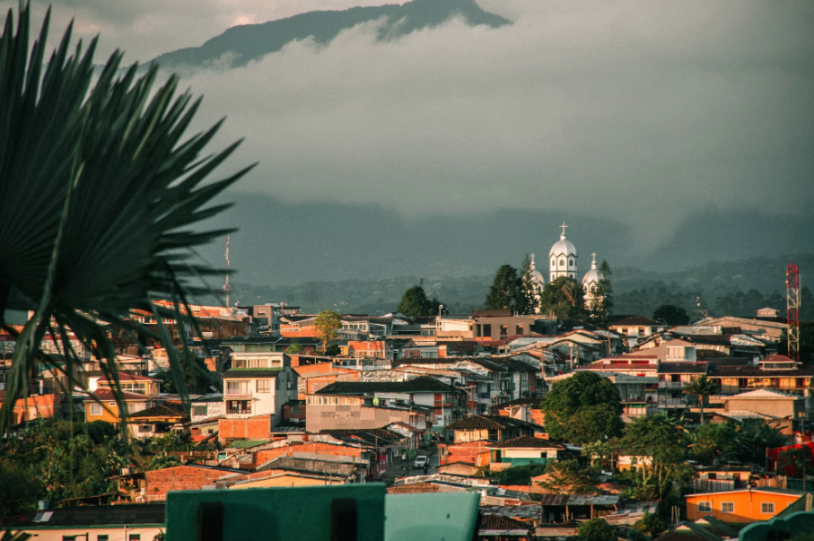
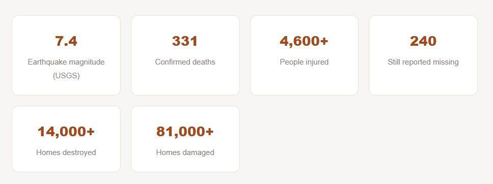
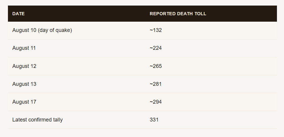
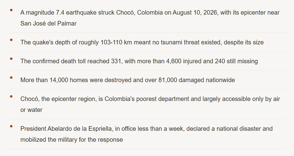
At 7:34 in the morning on August 10, 2026, the ground beneath western Colombia shook for what survivors would later describe as an unusually long, rolling tremor, not the sharp, sudden jolt many associate with earthquakes, but a deep, sustained shudder that gave people just enough warning to realize something serious was happening before buildings began coming down. By the time the aftershocks settled into a steady rhythm over the following days, Colombia was facing its deadliest earthquake since 1999, a disaster that has tested a brand-new presidential administration less than a week into office. What Actually Happened That Morning The United States Geological Survey recorded the earthquake at magnitude 7.4, with its epicenter roughly 5 kilometers east of San José del Palmar, a small town of under 2,400 people in Colombia's Chocó department, about 240 kilometers west of Bogotá. The Colombian Geological Service initially reported a lower magnitude of 6.6 before revising the figure upward to match USGS estimates. Crucially, the quake occurred at a depth of approximately 103 to 110 kilometers below the surface, classifying it as an intermediate-depth earthquake rather than a shallow one. That depth turned out to matter enormously for how the disaster unfolded. Colombia's National Unit for Disaster Risk Management and the Pacific Tsunami Warning Center both confirmed early on that no tsunami threat existed, despite the earthquake's substantial magnitude, precisely because intermediate and deep earthquakes generally don't displace the ocean floor the way shallow undersea quakes do. The shaking itself, however, radiated outward with tremendous reach: an estimated 1.9 million people felt very strong shaking, with tremors reported as far away as Bogotá, Medellín, and Cali, and felt across the borders in Ecuador and Panama. Colombia is full of active fault lines. The question isn't whether an earthquake like this can happen again, it's when. A Death Toll That Kept Climbing for Days Unlike disasters where the scale becomes clear within hours, this earthquake's true toll emerged gradually and painfully over more than a week, as rescue teams reached increasingly remote and difficult terrain. Initial reports Monday afternoon cited around 77 to 132 deaths. By Tuesday, the figure had climbed past 200. By Wednesday, President Abelardo de la Espriella, who had taken office only five days before the earthquake struck, confirmed at least 265 dead with nearly 500 officially missing, though independent, civilian-run databases put the missing figure above 4,100 at that point. By August 17, one week on, Colombian authorities reported at least 294 confirmed deaths, roughly 4,190 injured, and 143 people still missing. Wikipedia's continuously updated tracking of the disaster later placed the confirmed toll at 331 deaths, more than 4,600 injuries, and 240 people still unaccounted for.
The physical destruction matched the human toll. Colombia's Disaster Risk Management Unit confirmed more than 170 buildings had collapsed nationwide, with over 12,000 homes completely destroyed and more than 74,000 additional residences damaged, figures that later rose further as assessment teams reached harder-hit rural areas, ultimately exceeding 14,000 destroyed homes and 81,000 damaged. Beyond housing, the quake damaged 18 health centers, 52 educational centers, 17 community centers, a pedestrian bridge, 20 road bridges, more than 200 roads, five airports, and 44 aqueducts, a scale of infrastructure damage that has complicated both rescue efforts and the longer recovery that now lies ahead.
Why Chocó Made This Disaster So Much Harder
The earthquake's epicenter sits in Chocó, widely recognized as Colombia's poorest department, where government statistics show more than two-thirds of the population living in poverty. Much of the region outside its capital, Quibdó, has no meaningful road network at all and is reachable only by boat or small aircraft, according to a 2021 assessment by the humanitarian analysis group ACAPS. That isolation, difficult even in ordinary circumstances, became a severe liability once rescue crews needed to reach communities near the epicenter quickly.
A region already carrying other burdens
Beyond its remoteness, Chocó has spent recent years contending with violence from organized armed groups, including the National Liberation Army, and a documented rise in injuries from landmines left behind by paramilitary activity. Local officials have previously described residents in parts of the department as afraid to walk certain areas for fear of triggering unexploded ordnance. That security backdrop has added yet another layer of complexity and caution to relief operations moving into the hardest-hit rural communities.
A New President's First Major Crisis
President de la Espriella had been in office barely a week when the earthquake struck, and he moved quickly to convene an emergency response committee, declaring a state of national disaster and mobilizing what he described as the country's entire military and police apparatus. His government announced that families affected by the disaster would receive rental subsidies, along with suspended utility bills and tax filing deadlines, while a car-free day was declared in Pereira, one of the hardest-hit cities, to allow search operations to proceed unobstructed by traffic.
International support arrived quickly as well. The International Rescue Committee confirmed its teams near the epicenter were monitoring damage to local infrastructure, including hospitals and clinics, while governments across the US, South America, Europe, and the Middle East pledged support for the ongoing rescue and recovery effort. In Cali, the country's third-largest city, Mayor Alejandro Eder reported at least 20 large structures had collapsed, including sections of a hospital's pediatric and neonatal wards, forcing emergency evacuations of newborns and young patients even as rescue crews worked to free others trapped in nearby rubble.
A search complicated by geography and aftershocks
Colombia's Geological Service recorded more than 70 aftershocks in the days immediately following the main quake, a level of continued seismic activity that repeatedly forced rescue teams to pause and reassess the stability of partially collapsed structures before continuing search operations. In Chocó specifically, recovery efforts were further slowed by landslide-blocked roads, a common secondary hazard in mountainous terrain following a major earthquake, cutting off some communities from ground-based aid delivery entirely and forcing continued reliance on helicopters and small aircraft well after the initial emergency response phase had begun elsewhere in the country.
How this compares to Colombia's seismic history
Rodrigo León Loya, a seismologist and geosciences professor at the University of the Andes, noted following the disaster that while the probability of another quake of similar magnitude striking the exact same area soon is low, Colombia's geology makes further significant seismic activity elsewhere in the country a certainty rather than a possibility. The country sits along one of the most seismically active margins on Earth, and this earthquake is now recognized as its deadliest since 1999, when a quake centered near Armenia killed more than 1,000 people. Unlike that disaster, which struck a densely populated urban corridor directly, this year's quake spread its damage across both major cities in the Coffee Axis region and one of the country's most remote, hard-to-reach departments simultaneously, a combination that has made this recovery effort unusually complex to coordinate.