 William BensonVIEW PROFILE →
Inside Uzuakoli's Erosion Crisis: How a Small Drainage Problem Became a Seven-Kilometer Emergency
A gully erosion site in Uzuakoli, Abia State began as a small water channel in 2016. Eight years and seven kilometers later, it has buried homes, wiped out farmland, and left five communities pleading for help.
A gully erosion site in Uzuakoli, Abia State began as a small water channel in 2016. Eight years and seven kilometers later, it has buried homes, wiped out farmland, and left five communities pleading for help.
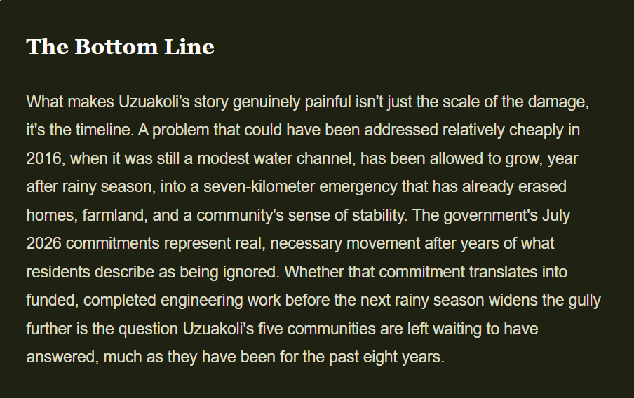
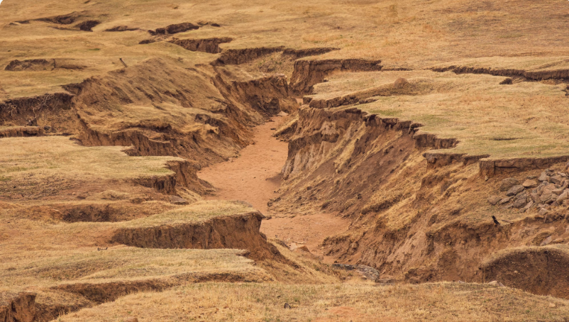
In 2016, residents of Amamba Uzuakoli in Abia State's Bende Local Government Area noticed a small channel of running water cutting through the edge of their land after a heavy rainy season. It looked, by most accounts, like an ordinary drainage nuisance, the kind that appears after a hard rain and usually fills back in on its own. Eight years later, that same channel has become a gully stretching more than seven kilometers, deep enough to have already buried multi-story buildings whole, and it is still growing with every rainy season that passes. A Ditch That Became a Chasm The scale of what's now happening across Uzuakoli's five affected communities, Amamba, Ngwu, Amankwo, Agbozu, and Eluama, is difficult to overstate. According to reporting from THISDAYLIVE, the gully has already buried three two-story buildings and four bungalows entirely, swallowed hectares of farmland, destroyed economic trees that families depended on for income, and rendered numerous households homeless outright. Dozens of additional structures now stand along the gully's crumbling edge, described by residents as being on borrowed time. Photographs obtained by Sahara Reporters from the site show a genuinely staggering scene: a cavernous pit spanning dozens of feet in both depth and width, with large sections of earth visibly crumbling into the void as multi-story residential buildings and electric poles sit mere inches from the drop. Even the Dodds Memorial Methodist Cathedral, a landmark church that also houses a primary school on its grounds, now hangs at the very edge of the erosion, putting both worshippers and schoolchildren at risk should the ground beneath it give way. This gully started like just a drop of water in 2016. We cried to all tiers of government, but nobody came. Why This Part of Nigeria Keeps Losing Ground Uzuakoli's crisis isn't an isolated freak occurrence, it's a particularly severe example of a geological vulnerability that runs across much of southeastern Nigeria. The region's soil is dominated by loose, sandy, poorly consolidated sediment that offers little natural resistance once its surface vegetation or drainage patterns are disturbed. Combine that soil composition with the area's intense seasonal rainfall, decades of unregulated road construction that redirects storm runoff without proper channeling, and gradual deforestation that strips away the root systems holding topsoil in place, and you get exactly the kind of runaway erosion now consuming Uzuakoli. Once a gully like this reaches a certain depth, it becomes largely self-perpetuating: each new rainy season sends more water crashing down the same weakened channel, undercutting the walls further and accelerating the collapse.
A Community That Tried to Solve It Themselves First
Long before any government agency stepped in, residents of Amamba Uzuakoli attempted to manage the crisis on their own terms. According to Vanguard News, the community pooled together roughly 6.5 million naira from its own members to fund temporary protective works at the erosion site, hoping that visible local effort and investment would prompt a more permanent government-led intervention to follow. For years, according to community leaders, that hoped-for follow-through simply didn't materialize, even as the gully continued expanding through repeated rainy seasons.
That frustration boiled into open public grief in mid-July 2026, when residents converged on their village square carrying placards, some weeping openly, others rolling on the ground in visible anguish, holding signs reading messages like "We have lost our farmlands to gully erosion" and "Uzuakoli in Bende LGA needs help." It was, by any measure, a community reaching the outer edge of its own capacity to cope without outside support.
Advocacy groups call it a humanitarian emergency, not just an environmental one
The Foundation For Environmental Rights, Advocacy & Development, a Nigerian civil society organization, has explicitly framed the Uzuakoli situation as both an ecological catastrophe and a humanitarian emergency requiring urgent, coordinated intervention. In a public statement, the group's executive director noted that decades of unchecked land degradation at the site have already endangered lives, destroyed livelihoods, displaced families, and placed critical public infrastructure directly at risk, language that positions this squarely alongside other slow-onset climate disasters rather than treating it as a routine infrastructure complaint.
What the Government Has Promised So Far
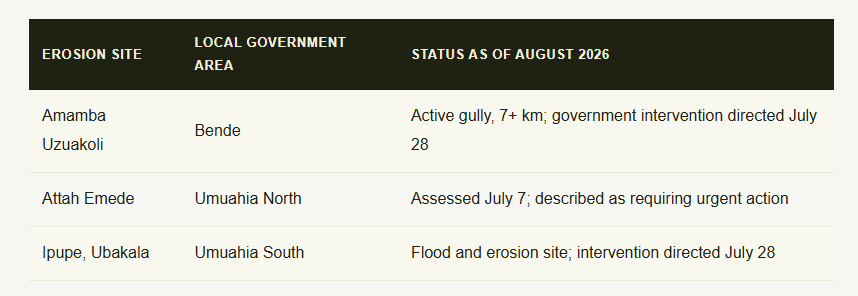
Movement finally came in mid-2026, though residents' patience had already worn thin by the time it arrived. On July 7, officials from Abia State's Ministry of Environment, working alongside the Nigeria Erosion and Watershed Management Project, a World Bank and European Investment Bank-supported initiative known as NEWMAP-EIB, conducted an on-the-spot assessment of the Uzuakoli site alongside a second severe erosion site at Attah Emede in Umuahia North. Commissioner for Environment Philemon Ogbonna described the destruction at both locations as alarming and pledged government intervention.
Three weeks later, following a State Executive Council meeting on July 28, Commissioner for Information Okey Kanu announced that Governor Alex Otti had formally directed the Ministry of Environment to launch urgent mitigation works at both the Uzuakoli site and a third erosion site at Ipupe, Ubakala in Umuahia South. Kanu also disclosed that a broader Abia State Climate Change Policy Document was awaiting the governor's final approval, framed as a longer-term step toward addressing environmental risk across the state more systematically. In the meantime, Commissioner Ogbonna has advised residents whose homes and farmland have already been destroyed to relocate immediately, describing the erosion sites as no longer safe for either habitation or farming.
Not everyone is convinced the response has matched the urgency of the situation. Sahara Reporters' review of Abia State's first-quarter 2026 financial records found what it described as a stark failure in capital budget execution specifically for environmental protection, raising pointed questions about whether the funding necessary to actually carry out the government's stated intervention plans has been allocated and disbursed at the pace the crisis demands.
A crisis bigger than any one gully
Uzuakoli's emergency sits within a much larger regional pattern. Southeastern Nigeria as a whole, spanning states including Abia, Anambra, Imo, and Enugu, is widely considered one of the most erosion-prone regions in West Africa, with thousands of active gully sites recorded across the area. The World Bank-backed NEWMAP program was specifically established to address this broader crisis, but the sheer number of active sites relative to available funding and engineering capacity means that severe, life-threatening gullies like Uzuakoli's can and do continue expanding for years even after being formally identified and flagged for intervention. That gap, between identifying a crisis and actually funding its fix at the pace erosion moves, is the thread connecting Uzuakoli to dozens of similar communities across the region that residents and advocacy groups say deserve far more urgent attention than they've received.